
Downtown San Antonio’s Savior: Olmos Dam
Olmos Dam
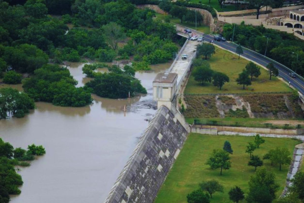
For years I would drive north on US 281 and wonder about the dam between the exits of Hildebrand Avenue and Basse Road. Olmos Dam sneaks up on you if you’re not paying attention…or speeding. The dam sits just east of US 281. Built several decades before the highway sliced through the woods, park, and a neighborhood (that’s another story for a later date). You can read a really quick history on the dam and it’s construction here and here from MySA.com. Olmos Dam, built between 1924-1926, is a perfect hiking spot that’s off the beaten path.
The best way to hike Olmos Dam is from its access at Olmos Basin Park or the Judson Nature Trail along Viesca Avenue in Alamo Heights near the public pool. However, you can park right underneath US 281 at Olmos Drive and walk along the sidewalk. Or at least I did. It’s not an official parking lot, but hey, I went rogue.
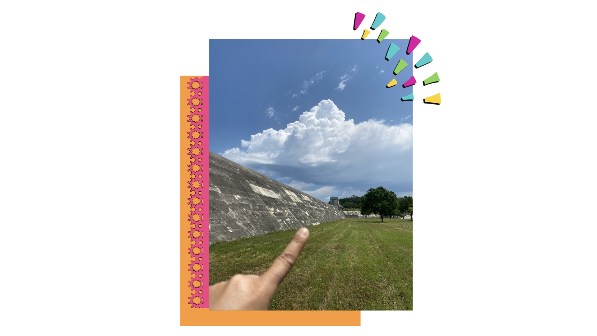
The hike is not particularly long or arduous, but it’s a good way to take in the extent of the dam from each end of it’s 2,000 ft length. From access on the Olmos Drive side, I recommend standing at the base of the dam to take in the slope of the walls and weep holes scattered across the surface.
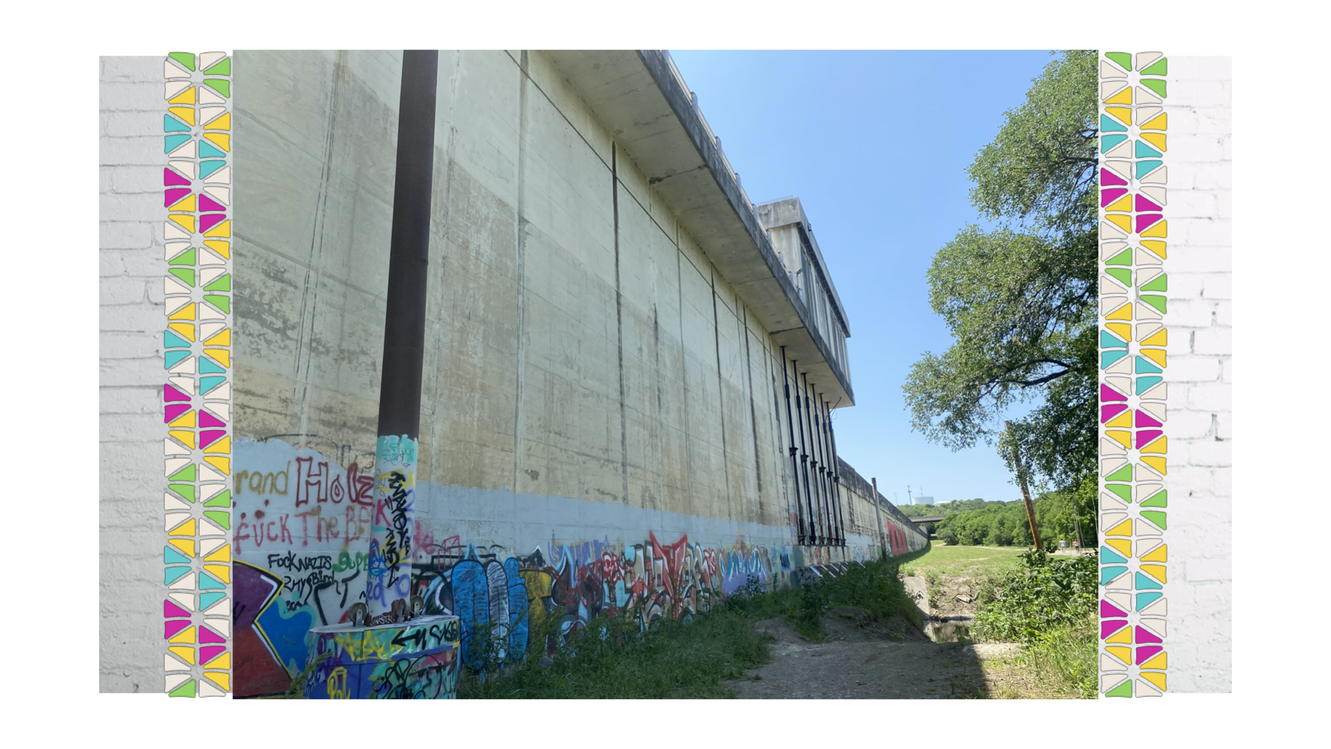
Once you find the access to get to the north facing wall of the damn, you’ll hike through a sparsely wooded area after walking down a colorful staircase from Olmos Drive. You’ll meander down a steep incline but then veer left (or west) on a well-worn trail that continues to the base of the dam. You’ll intersect with another trail going right (or north) which is the trail that comes in from the Judson Nature Trails access. At the base of the dam along the wall you’ll find graffiti art which anybody can appreciate when it’s really creative and unique.
Where, What, and How to Get There
Tucked away between Olmos Park and Alamo Heights, Olmos Dam was strategically placed just north of the confluence of Olmos Creek and the San Antonio River springs. Now, even though there had been other damaging flood episodes prior to 1921, the flood of 1921 took everyone by surprise. The downtown and surrounding areas took several years to recover. After that, the city had to make sure that level of devastation wouldn’t happen again.
Unfortunately, the history on the development of the dam and subsequent land use is indicative of the disparities in San Antonio in the early twentieth century. The city, of course, focused only on preventing any further devastation to downtown. Beautifully outlined in this project by Anam Mehta, the ArcGIS storymap highlights the people and communities that were severely affected from the flood (San Antonio’s West Side) and the dam’s failure to protect it’s most vulnerable populations.
This was waaay before environmental justice was a thing y’all. As of this blog post, it’s been 100 years since the flood ravaged the city. The West Side continued to flood even after the dam was constructed. With frequent flooding, the community took longer to recover. Along with the dam, the most impactful legacy is the Latino environmental justice movement that developed.
For more depth, check out West Side Rising: How San Antonio’s 1921 Flood Devastated a City and Sparked a Latino Environmental Justice Moment. The book illustrates the history, struggles, and courageous local leaders that fought for their community. You can also catch an interview with the author, Char Miller, here on TPR’s Fronteras.
Since it’s completion in 1928, this flood control structure serves as a silent defender of downtown San Antonio. The low lying floodplain of Olmos Creek, also known as Olmos Basin, is a park on either side of US 281. This expansive floodplain contained a gazillion archaeological sites likely related to the Payaya and older inhabitants that were native to Central Texas.
Maybe not a gazillion, but a whole bunch of sites that could’ve easily been an archeological district. Evidence along the entire banks of Olmos Creek spanned thousands of years of occupation. And yes, I do mean in the thousands of years. A more detailed discussion on the archaeology of Olmos Dam is located here provided by Texas Beyond History.
Dam Good Hike
If you ever make your way to Olmos Dam, I highly recommend you explore both sides of it. Take in the floodgates from its southern facade along Olmos Drive. Its the only portion where it still retains the arches it once had across the entire dam. As you walk towards the top of the dam, you’ll see a part of the old road that used to span across the top of it before they blew it up to make the spillway. Then on the northern facade, you can really get up close and appreciate its height.
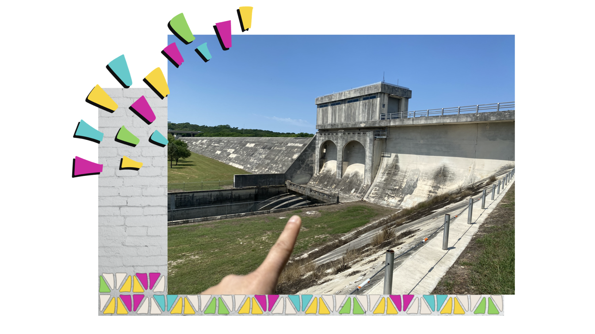
Continuing along the path towards Olmos Creek you’ll get another perspective of the flood gates on the dam’s northern facade. The creek looks so unassuming that you think, ‘This is it?’ But as news stories and photos from the 1998 and 2013 floods show, this area can change quickly with heavy rains. What you don’t see is the giant underground storm drain built further down stream to help divert water underneath downtown. This dynamic duo of flood control has effectively reduced damaging flood waters from wreaking havoc downtown.
Look, I know it’s weird to be totally gushing over a dam. You might be saying, ‘What the heck is with this chick? It’s a freakin dam.’ Well, yes and no. It’s more than just a dam. It’s more than just a floodplain. There is so much history and heartache in this little engineering structure. It may not be as amazing or as notable as the Hoover Dam, but Olmos Dam is entirely underrated. The dam will celebrate its 100 year birthday around 2025-2028. So I can only hope that San Antonio, seeing as how it’s been saved MULTIPLE times by it, will throw Olmos Dam the giant party it deserves.
Have you visted Olmos Dam? Tell me about it!


Thanks for sharing all of that history and information! I had no idea the development of the dam and the subsequent land was indicative of the disparities in San Antonio! I also love how you can explore the dam itself and a little bit of the surrounding area to take in its vastness.